Hiking: Fiery Gizzard Trail | |||||||
| The Basics: | |||||||
| Event Type: | Hike | ||||||
| Event Location: |
Grundy Forest Natural Area near Tracy City, TN


| ||||||
| Date(s) & Time: | Sat, May 14 2011 10:00 am >> Sat, May 14 2011 5:00 pm (Carpool Departure: 8:00 am *log in for location*) | ||||||
| Registration Opens: | Wed, May 4 2011 9:00 pm | ||||||
| Registration Cut Off: | Fri, May 13 2011 8:00 pm | ||||||
| Event Duration: | 7 Hours | ||||||
| Difficulty Rating: | D4: Moderate to Difficult | ||||||
| Pace: | Fast | ||||||
| Trip Leader(s): | Chris L Email Trip Leader(s) Email Trip Leader(s)
You must be logged in to get the Trip Leader contact information. | ||||||
| Member Cost: | None | ||||||
| Participant Info: | |||||||
| Who's Invited: | Members Only, 21 And Older Only | ||||||
| Maximum Group Size: | 16 | ||||||
| Minimum Group Size: | 4 | ||||||
| Number Registered So Far: | 15 / 0 (To see who's signed up, log in to the Member Area) | ||||||
| Are Dogs Permitted: | Yes | ||||||
| Itinerary: | |||||||
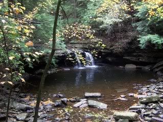
Take a Saturday to enjoy a very unique trail in the beautiful South Cumberland Recreation Area near Tracy City, TN. For the most part this is a loop trail with a total of 10 1/2 miles roundtrip hiking. We'll be hiking part of the Fiery Gizzard Trail and starting at the northern trailhead of Grundy Forest State Natural Area. The trail features many waterfalls, cascading streams, gentle slopes, lush woodlands, spectacular rock formations, extremely rocky gorges and even a very small cave opening. We'll have an arduous climb before reaching a natural sandstone bridge and a short hike to Raven Point. Raven point is where we will stop for lunch and hopefully have some beautiful views. PLEASE READ THE FOLLOWING BEFORE SIGNING UP FOR THIS HIKE!
| |||||||
| |||||||
| How to Get There: | |||||||
| Event Directions: | Driving Directions: Grundy Forest State Natural Area in Tracy City, TN •From Chastain Road Park and Ride lot, take I-75 N. •Get off on exit 333 (Dalton) for restroom stop at McDonalds on the right. •Continue I-75 N into Chattanooga •Take I-24 West to exit 135 (Monteagle) •Go North on U.S. 64/41 and at .6 mi. take 41 S. •We should pass the South Cumberland Visitor Center. •Drive 2.3 miles past Visitor Center to Third Street and turn right. You should see signs for Grundy Forest State Natural Area. We’ll be parking in the Day use picnic area and day loop hiking. There are restroom facilities at the parking area. | ||||||
| Carpool to Event Distance (round trip): | 300Mile(s) | ||||||
| Carpool Departure Time: | 8:00 am | ||||||
| Carpool Location: | Log in for location | ||||||
| Carpool Directions: | Log in for directions | ||||||
| Carpool Cost: | Estimated cost per vehicle for this event is $120.00 using a reimbursement rate guideline of $0.400 per mile. The total amount should be divided by the number of people in the vehicle, including the driver. This is a guideline, not a rule, for drivers but the cost should not be higher unless there are extenuating circumstances. | ||||||
| Notes: | |||||||
|
Will this event occur rain or shine? No, not in severe weather * We encourage all members to follow our Etiquette Guidelines while participating in AOC events. | |||||||
Cancellation/Partial Attendance: Please review the AOC cancellation policy. | |||||||


