

 Print-Friendly Version Print-Friendly Version
|
Day Hike: Yonah Mountain | |||||||
| The Basics: | |||||||
| Event Type: | Hike | ||||||
| Event Location: | Cleveland, Ga | ||||||
| Date(s) & Time: | Sat, Feb 9 2008 10:00 am >> N/A (Carpool Departure: 8:15 am *log in for location*) | ||||||
| Registration Opens: | Mon, Feb 4 2008 12:00 am | ||||||
| Registration Cut Off: | Fri, Feb 8 2008 11:59 pm | ||||||
| Event Duration: | Approx: 6 hours including time to and from carpool | ||||||
| Difficulty Rating: | D4: Moderate to Difficult | ||||||
| Trip Leader(s): | Tracey Steiner Tony C  Email Trip Leader(s) Email Trip Leader(s)
You must be logged in to get the Trip Leader contact information. | ||||||
| Member Cost: | None | ||||||
| Participant Info: | |||||||
| Who's Invited: | Members Only, 21 And Older Only | ||||||
| Maximum Group Size: | 16 | ||||||
| Minimum Group Size: | 4 | ||||||
| Number Registered So Far: | 11 / 0 (To see who's signed up, log in to the Member Area) | ||||||
| Are Dogs Permitted: | No | ||||||
| Itinerary: | |||||||
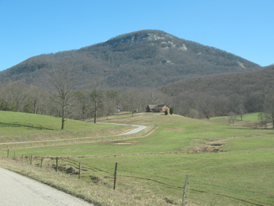
Have you ever hiked Mount Yonah? Here's your opportunity to join us for a hike up this beautiful and scenic natural wonder located in North Ga. We'll begin by hiking at a moderate pace up the main Mount Yonah trail (approx. 1500 ft elevation gain in around 2.5 miles). As we near the top, we will veer off the main trail and hike along the side of the exposed rock face. While it is safe, if you have an extreme fear of heights, this may not be the best hike for you. We will slow and linger in this area to fully enjoy the panoramic views, take photos, etc. Depending on the weather, we will either take a break for lunch at an overlook or at the actual summit of Yonah, which is surrounded by trees and less windy. We will also be taking one or more side trails to some interesting rock formations. As a bonus, we may actually have the opportunity to watch some rock climbers as this is a very popular area for them. Although the total distance of this hike is just around 6-7 miles, it does involve some steeps sections and rocky terrain, and should prove to be moderately strenuous. So we should get a good workout on the way up, along with hopefully some great views if the weather cooperates. PLEASE NOTE: | |||||||
| |||||||
| How to Get There: | |||||||
| Event Directions: | Directions to Trailhead: Directions will also be given at carpool. | ||||||
| Carpool to Event Distance (round trip): | 120Mile(s) | ||||||
| Carpool Departure Time: | 8:15 am | ||||||
| Carpool Location: | Log in for location | ||||||
| Carpool Directions: | Log in for directions | ||||||
| Carpool Cost: | Estimated cost per vehicle for this event is $48.00 using a reimbursement rate guideline of $0.400 per mile. The total amount should be divided by the number of people in the vehicle, including the driver. This is a guideline, not a rule, for drivers but the cost should not be higher unless there are extenuating circumstances. | ||||||
| Notes: | |||||||
|
Are dogs allowed? No Will this event occur rain or shine? No, because the trail to the top and the rock face will be come slippery when wet * We encourage all members to follow our Etiquette Guidelines while participating in AOC events. | |||||||
Cancellation/Partial Attendance: Please review the AOC cancellation policy. | |||||||