

 Print-Friendly Version Print-Friendly Version
|
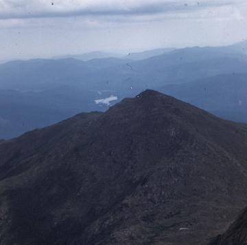
Rocky and Tray Mountains from Unicoi Gap | |||||||
| The Basics: | |||||||
| Event Type: | Hike | ||||||
| Event Location: | Unicoi Gap | ||||||
| Date(s) & Time: | Tue, May 16 2023 8:00 am >> Tue, May 16 2023 4:30 pm (Carpool Departure: 8:00 am *log in for location*) | ||||||
| Registration Opens: | Wed, May 10 2023 7:00 am | ||||||
| Registration Cut Off: | Tue, May 16 2023 6:30 am | ||||||
| Event Duration: | 8 Hours 30 Minutes | ||||||
| Difficulty Rating: | D5: Difficult | ||||||
| Distance: | 10.2 Miles | ||||||
| Pace: | Moderate | ||||||
| Trip Leader(s): | Gary Hubert Email Trip Leader(s) Email Trip Leader(s)
You must be logged in to get the Trip Leader contact information. | ||||||
| Member Cost: | None | ||||||
| Participant Info: | |||||||
| Who's Invited: | Members Only, 21 And Older Only | ||||||
| Maximum Group Size: | 10 | ||||||
| Minimum Group Size: | 3 | ||||||
| Number Registered So Far: | 4 / 0 (To see who's signed up, log in to the Member Area) | ||||||
| Are Dogs Permitted: | No | ||||||
| Itinerary: | |||||||
This section contains some of the longest climbs and highest peaks on the AT in Georgia. Previous experience hiking in the mountains is needed for this event. We will begin the hike at Unicoi Gap and hike northbound on the Appalachian Trail uphill to reach the summit of Rocky Mountain where we will be rewarded with views to the south (possibly including the ATL skyline on a clear day). Next, we will make the long descent to Indian Grave Gap and then begin the long ascent to Tray Mountain with another great view along the way. The summit of Tray mountain will provide views to the north and south. Tray Mountain is the 5th highest peak in GA and the 2nd highest on the Georgia AT. We will stop to take in the views before continuing on the AT to a spur trail that takes us to a large outcrop with sweeping views to the east (our lunch spot). After that, we will turnaround and head back to where we started at Unicoi Gap. Trail Facts: Elevation Gain: 3200.8 feet total Total Grade: 626.8 feet/mile Moving speed: approx. 2.5mph avg. This section contains some of the longest climbs and highest peaks on the AT in Georgia. It rarely descends below 3500 feet. The trail leads through the Tray Mountain Wilderness. This hike will cross the summits of Rocky Mountain (3992 feet) and Tray Mountain (4430 feet).
| |||||||
| |||||||
| How to Get There: | |||||||
| Event Directions: | "Unicoi Gap" on google maps.
OR
North on GA 400 from Atlanta. When GA 400 ends at Chevron station. continue on GA 115. Go 4.8 miles where GA 115 meets GA 52. Turn right. Continue on GA 115 until Cleveland GA. At traffic circle in Cleveland go north on US 129. Please arrive at the trailhead by 9:30AM if meeting directly at the event. | ||||||
| Carpool to Event Distance (round trip): | 140Mile(s) | ||||||
| Carpool Departure Time: | 8:00 am | ||||||
| Carpool Location: | Log in for location | ||||||
| Carpool Directions: | Log in for directions | ||||||
| Carpool Cost: | Estimated cost per vehicle for this event is $56.00 using a reimbursement rate guideline of $0.400 per mile. The total amount should be divided by the number of people in the vehicle, including the driver. This is a guideline, not a rule, for drivers but the cost should not be higher unless there are extenuating circumstances. | ||||||
| Notes: | |||||||
|
Please arrive at the trailhead by 9:30AM if meeting directly at the event. * We encourage all members to follow our Etiquette Guidelines while participating in AOC events. | |||||||
Cancellation/Partial Attendance: Please review the AOC cancellation policy. | |||||||