

 Print-Friendly Version Print-Friendly Version
|
AT from Woody Gap to Justus Mountain and back | |||||||
| The Basics: | |||||||
| Event Type: | Hike | ||||||
| Event Location: |
Suches, GA


| ||||||
| Date(s) & Time: | Sun, Aug 27 2023 8:30 am >> Sun, Aug 27 2023 3:00 pm | ||||||
| Registration Opens: | Wed, Aug 23 2023 7:00 pm | ||||||
| Registration Cut Off: | Sat, Aug 26 2023 4:00 pm | ||||||
| Event Duration: | 6 Hours 30 Minutes | ||||||
| Difficulty Rating: | D5: Difficult | ||||||
| Distance: | 15 Miles | ||||||
| Pace: | Moderate | ||||||
| Trip Leader(s): | Ann Ralph Howard  Email Trip Leader(s) Email Trip Leader(s)
You must be logged in to get the Trip Leader contact information. | ||||||
| Member Cost: | None | ||||||
| Participant Info: | |||||||
| Who's Invited: | Members Only, 21 And Older Only | ||||||
| Maximum Group Size: | 8 | ||||||
| Minimum Group Size: | 2 | ||||||
| Number Registered So Far: | 4 / 0 (To see who's signed up, log in to the Member Area) | ||||||
| Are Dogs Permitted: | No | ||||||
| Itinerary: | |||||||
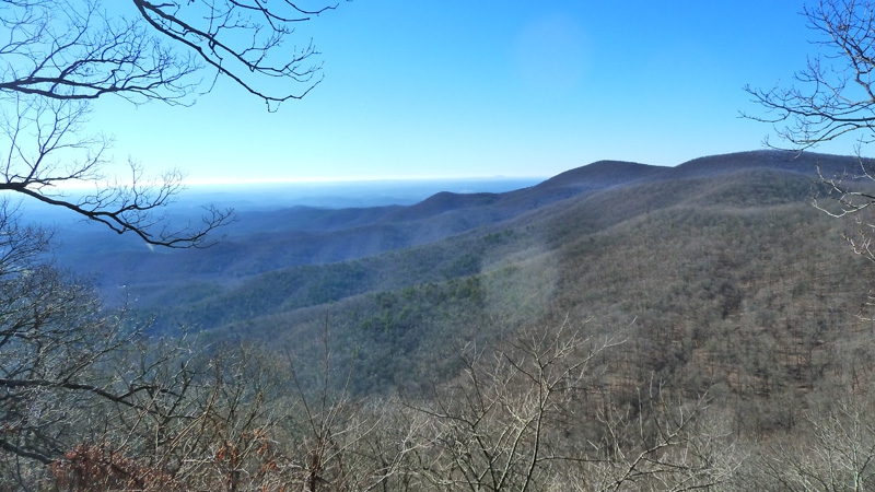
Join us for this 15 mile segment of the AT. We will hike south from Woody Gap trailhead parking (across the GA 60 road from the privy), skirt 4 mountains (Black, Ramrock, Gooch, and Justus Mountains) and enjoy 3 streams including Blackwell and Justus creeks before turning around at an old logging road and retracing our steps. We will stop for lunch at the Gooch Mountain shelter or another suitable location. Mileage: 15 Elevation Gain: 2700 feet Moving speed: around a 2.3 mph on the uphill portions and around a 3.0 mph on the flats and downhill. Location: Chattahoochee National Forest; 15 miles west of Dahlonega YOU MUST HAVE A RECENT (this year) D5 to participate in this event, otherwise, sorry, but you will not be allowed on the event. We will stay together and hike as a group at a moderate pace. | |||||||
| |||||||
| How to Get There: | |||||||
| Event Directions: | North on GA 400. Take a left onto SR 60/19 toward Dahlonega. At the fork of SR 60 and SR 19, go straight on SR 60. The trailhead is on the left at Woody Gap. All roads are paved. Click the link for Google Maps navigation to Woody Gap trailhead:
| ||||||
| Notes: | |||||||
|
* We encourage all members to follow our Etiquette Guidelines while participating in AOC events. | |||||||
Cancellation/Partial Attendance: Please review the AOC cancellation policy. | |||||||