

 Print-Friendly Version Print-Friendly Version
|
Beginner Backpacking and learn, Springer Mountain to Three Forks | |||||||
| The Basics: | |||||||
| Event Type: | Backpacking | ||||||
| Event Location: |
Springer Mountain trailhead parking lot


| ||||||
| Date(s) & Time: | Sat, Nov 18 2023 9:00 am >> Sun, Nov 19 2023 4:00 pm (Carpool Departure: 7:00 am *log in for location*) | ||||||
| Registration Opens: | Mon, Nov 13 2023 10:00 am | ||||||
| Registration Cut Off: | Fri, Nov 17 2023 2:00 pm | ||||||
| Event Duration: | 1 Days 7 Hours | ||||||
| Difficulty Rating: | D5: Difficult | ||||||
| Distance: | 12 Miles | ||||||
| Pace: | Moderate | ||||||
| Trip Leader(s): | Bob Bunner Chuck M  Email Trip Leader(s) Email Trip Leader(s)
You must be logged in to get the Trip Leader contact information. | ||||||
| Member Cost: | None | ||||||
| Participant Info: | |||||||
| Who's Invited: | Members Only, 21 And Older Only | ||||||
| Maximum Group Size: | 8 | ||||||
| Minimum Group Size: | 4 | ||||||
| Number Registered So Far: | 5 / 0 (To see who's signed up, log in to the Member Area) | ||||||
| Are Dogs Permitted: | No | ||||||
| Itinerary: | |||||||
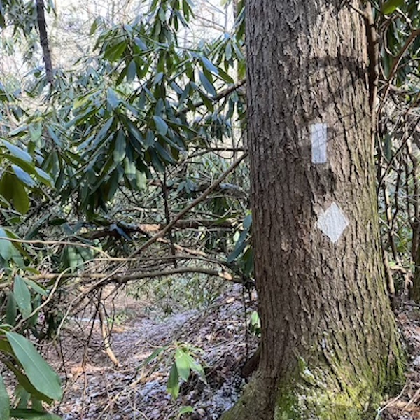
This event is Chuck's second event as a potential trip leader. It is designed to help beginning backpackers get ready for more rigorous backpacking events. While it is a D5 in difficulty, it is on the low end of the category. We will be hiking just over 11.6 miles altogether while climbing about 2,300 feet. We will be hiking as a group at a moderate pace. We will see the southern terminus of the Appalachian Trail, and nearby the southern terminus of the Benton McKaye trail. There are impressive views from Springer Mountain, and on our return hike there is a great view just off the BMT. On Saturday we will hike about 5 miles on the AT with only about 500 feet of climbing. We will start at the parking for Springer Mountain trailhead at Big Stamp Gap. From there we will hike a mile to the top of Springer Mountain, then turn around and hike on the AT to Three Forks, where we will set up camp. After setting up camp we will have lunch and discuss techniques, skills, and equipment used for backpacking. Chuck will discuss different philosophies for reducing pack weight to increase backpacking enjoyment. After the discussion there will be an optional hike of about a mile each way to Long Creek Falls. Sunday we will have breakfast, break camp, and hike back to our start on the Benton McKaye trail. It will be about 6.6 miles with 1,800 feet of climbing, so a good bit more challenging than the first day. But we will be rewarded with spectacular views and more solitude on this lesser-travelled trail. A map of the route is in the "Notes" below, and can be found here: https://www.alltrails.com/explore/map/trail-planner-map-2cbca44-32?u=i&sh=x3ofo8 Thanks to Horhay for the above photo. | |||||||
| |||||||
| How to Get There: | |||||||
| Event Directions: | The coordinates linked above at "Location" are to the parking lot for the Springer Mountain Trailhead. Copy the coordinates into Google or Apple Maps for directions. | ||||||
| Carpool to Event Distance (round trip): | 170Mile(s) | ||||||
| Carpool Departure Time: | 7:00 am | ||||||
| Carpool Location: | Log in for location | ||||||
| Carpool Directions: | Log in for directions | ||||||
| Carpool Cost: | Estimated cost per vehicle for this event is $68.00 using a reimbursement rate guideline of $0.400 per mile. The total amount should be divided by the number of people in the vehicle, including the driver. This is a guideline, not a rule, for drivers but the cost should not be higher unless there are extenuating circumstances. | ||||||
| Notes: | |||||||
|
* We encourage all members to follow our Etiquette Guidelines while participating in AOC events. | |||||||
Cancellation/Partial Attendance: Please review the AOC cancellation policy. | |||||||