

 Print-Friendly Version Print-Friendly Version
|
Paddle the Historic Oostanaula River | |||||||
| The Basics: | |||||||
| Event Type: | Water | ||||||
| Event Location: |
Calhoun, GA


| ||||||
| Date(s) & Time: | Sun, Oct 20 2024 10:00 am >> Sun, Oct 20 2024 4:00 pm | ||||||
| Registration Opens: | Sun, Oct 13 2024 11:00 am | ||||||
| Registration Cut Off: | Sun, Oct 20 2024 9:00 am | ||||||
| Event Duration: | 6 Hours | ||||||
| Difficulty Rating: | D3: Moderate (Exploratory) | ||||||
| Distance: | 12 Miles | ||||||
| Pace: | Moderate | ||||||
| Trip Leader(s): | Jerry K Email Trip Leader(s) Email Trip Leader(s)
You must be logged in to get the Trip Leader contact information. | ||||||
| Member Cost: | None | ||||||
| Participant Info: | |||||||
| Who's Invited: | Members Only, 21 And Older Only | ||||||
| Maximum Group Size: | 10 | ||||||
| Minimum Group Size: | 3 | ||||||
| Number Registered So Far: | 8 / 0 (To see who's signed up, log in to the Member Area) | ||||||
| Are Dogs Permitted: | Yes | ||||||
|
Note: This is an "EXPLORATORY" trip. This means that there are parts of this trip, or perhaps the whole trip, that is new to your Trip Leader(s). However, they are confident that this will not be an issue. This note is here so that you can make an informed decision. When a Trip Leader isn't personally familiar with a trip, there is an increased chance of things not going as planned and you need to be prepared. The Trip Leader may have additional details in the itinerary. | |||||||
| Itinerary: | |||||||
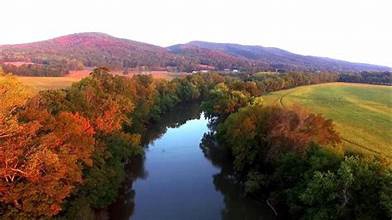
Come paddle on the Oostanaula River in Calhoun Total mileage is 12 miles with a moderate pace we'll stop to eat along the way. We'll meet at the boat ramp at 10:00 a.m. to unload gear and set up a shuttle to the take-out. Approximate time to begin paddling is 10:30 to 10:45. Approximate time on the river is 5 to 6 hours. The trip begins at the boat ramp on GA 225 a few miles from Calhoun, GA near the New Echota Historical Site. This spot is also the confluence of the Conasauga and Coosawattee Rivers flowing from Tennessee and North Georgia to form the Oostanaula. The Oostanaula flows west and south to converge with the Etowah to form the Coosa River at Rome, GA. The paddle is on calm moving waters with an ancient fish trap (weir) just a mile or so into the paddle. At mile 4 we pass under the I-75 at Resaca, the site of an important floating bridge crossing during the Civil War that turned a stalemated battle into a Union victory. From miles 6 to 8 there are small shoals to lighten up the day. We will plan to stop for a snack lunch along the way. Bring plenty of water, and other hydration devices, along with snacks or a lunch. Take out is in the city of Calhoun at North River Street Boat Ramp. We can shuttle back up to pick up any cars at the put-in. THIS IS a BYOBoat trip as there are no Outfitters nearby. PFD's (life jackets) and Paddles are required equipment. NO INFLATABLE rafts or tubes are allowed. If you have any questions, please contact the trip leader by email or phone. Newer paddlers are welcome as this is a stretch to get a feel for distances beyond what you might normally consider! Disclosure - Credit is given to Bobby Marie for part of the write up and all of the historic information cited above. This write up is in part a reflection of Bobby's write up in 2014.
THIS IS A WEATHER PERMITTING EVENT | |||||||
| |||||||
| How to Get There: | |||||||
| Event Directions: | The put-in is at the GA 225 Bridge at the river. North on I-75 to exit 317 (GA 225). Turn right and follow the highway 1 mile to the ramp on the left side of the road. Boat ramp is approximately 1/2 mile past the historic site on the left side of the road, BEFORE the bridge. Turn in and park to unload boats. We will run the shuttle from here. GPS coordinates: 34.540849, -84.901604
The take-out is the North River Street boat ramp, which is located at: 201 N River St
Calhoun, GA 30701
Directions will be provided at the put-in meeting place or use GPS for the address.
| ||||||
| Notes: | |||||||
|
* We encourage all members to follow our Etiquette Guidelines while participating in AOC events. | |||||||
Cancellation/Partial Attendance: Please review the AOC cancellation policy. *Note: This is a weather permitting event. It will be cancelled if the weather shows a strong chance of rain or storms. Temperature will not affect the paddle. | |||||||