 Print-Friendly Version Print-Friendly Version
|
|
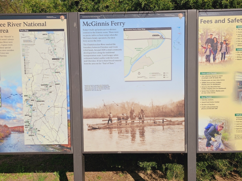
CRNRA Hidden Gems Part 4: McGinnis Ferry (+ Shakerag Park) | |||||||
| The Basics: | |||||||
| Event Type: | Hike | ||||||
| Event Location: |
Johns Creek, GA


| ||||||
| Date(s) & Time: | Sun, Mar 23 2025 3:00 pm >> Sun, Mar 23 2025 5:30 pm | ||||||
| Registration Opens: | Fri, Mar 21 2025 12:00 pm | ||||||
| Registration Cut Off: | Sun, Mar 23 2025 5:00 pm | ||||||
| Event Duration: | Approx 2 1/2 hrs | ||||||
| Difficulty Rating: | D2: Easy to Moderate | ||||||
| Distance: | 5.5 Miles | ||||||
| Pace: | Moderate | ||||||
| Trip Leader(s): | Tony C Email Trip Leader(s) Email Trip Leader(s)
You must be logged in to get the Trip Leader contact information. | ||||||
| Member Cost: | None | ||||||
| Participant Info: | |||||||
| Who's Invited: | Members Only, 21 And Older Only | ||||||
| Maximum Group Size: | 8 | ||||||
| Minimum Group Size: | 2 | ||||||
| Number Registered So Far: | 8 / 0 (To see who's signed up, log in to the Member Area) | ||||||
| Are Dogs Permitted: | No | ||||||
| Itinerary: | |||||||
Of course many of us enjoy the Chattahoochee River National Recreation Area (CRNRA) units, around metro ATL. However there are a few that are relatively obscure, but well worth checking out and exploring. It turns out they are each "hidden in plain sight". They can be found on various official maps, but somehow they've largely flown under the radar, as far as past AOC events have gone. The total distance is about 5.5 miles and there's only around 150' of total ascent, so overall it's a light D2 and some decent exercise. | |||||||
| |||||||
| How to Get There: | |||||||
| Event Directions: | 34°02'46.8"N 84°07'31.4"W If by some chance all the parking is full, you can park next door at River Trail Middle School and and walk over. We will meet by the main sign, at the park entrance.
| ||||||
| Notes: | |||||||
|
Parking is free, and there are bathrooms at the trailhead, at Shakerag Park. * We encourage all members to follow our Etiquette Guidelines while participating in AOC events. | |||||||
Cancellation/Partial Attendance: Please review the AOC cancellation policy. | |||||||
 Calendar of Events
 Event Places