

 Print-Friendly Version Print-Friendly Version
|
Walhalla Fish Hatchery Loop Trail | |||||||
| The Basics: | |||||||
| Event Type: | Hike | ||||||
| Event Location: | Walhalla, SC | ||||||
| Date(s) & Time: | Sat, Jan 10 2015 7:45 am >> Sat, Jan 10 2015 6:00 pm (Carpool Departure: 7:45 am *log in for location*) | ||||||
| Registration Opens: | Fri, Jan 2 2015 8:00 pm | ||||||
| Registration Cut Off: | Thu, Jan 8 2015 5:00 pm | ||||||
| Event Duration: | 10 Hours 15 Minutes | ||||||
| Difficulty Rating: | D4: Moderate to Difficult | ||||||
| Distance: | 10.7 Miles | ||||||
| Pace: | Moderate | ||||||
| Trip Leader(s): | Ann Ralph Howard  Email Trip Leader(s) Email Trip Leader(s)
You must be logged in to get the Trip Leader contact information. | ||||||
| Member Cost: | None | ||||||
| Participant Info: | |||||||
| Who's Invited: | Members Only, 21 And Older Only | ||||||
| Maximum Group Size: | 12 | ||||||
| Minimum Group Size: | 5 | ||||||
| Number Registered So Far: | 9 / 0 (To see who's signed up, log in to the Member Area) | ||||||
| Are Dogs Permitted: | No | ||||||
| Itinerary: | |||||||
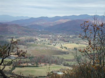
Black Rock Mountain State Park is closed until spring (boo!). So we've replaced the James E hike with this little adventure. Moderately Strenuous 10.7 Miles Starting at the Burrells Ford Campground Parking lot we ascend (that's a fancy word for climbing uphill) to where we meet the Chattooga River trail and then continue ascending up Medlin Mountain. At the 3.9 mark we intersect with the Fish Hatchery Road and it's a gradual descent to the Hatchery which is at the 5.7 mark. We'll feast on our delicious meals before continuing along the East Fork Trail to the Chattooga Trail; we'll take a short side trail to Spoon Auger Falls (sounds interesting, so lets take in the view) before backtracking to the loop trail and continuing to Burrells Ford Road at 9.7 and our parking lot at a little over 10 miles. Adding in the side trail we should hit somewhere around 10.7 miles. We will discuss food options (dinner) at the carpool. We should begin hiking at 10AM and finish by 3PM; back to the park and ride by 6PM (at the latest). | |||||||
| |||||||
| How to Get There: | |||||||
| Event Directions: | From the SC Visitor Center we will take scenic highway 11 into Walhalla, we will then take SC 28 for 7.5 miles then bear right on SC 107, drive 10 miles then turn left on Burrells Ford Road. The parking area is approximately 3 miles ahead on the left. We will hand out driving directions. Plan on stopping at the SC Visitor
exit for a bio break and to regroup. | ||||||
| Carpool to Event Distance (round trip): | 244Mile(s) | ||||||
| Carpool Departure Time: | 7:45 am | ||||||
| Carpool Location: | Log in for location | ||||||
| Carpool Directions: | Log in for directions | ||||||
| Carpool Cost: | Estimated cost per vehicle for this event is $97.60 using a reimbursement rate guideline of $0.400 per mile. The total amount should be divided by the number of people in the vehicle, including the driver. This is a guideline, not a rule, for drivers but the cost should not be higher unless there are extenuating circumstances. | ||||||
| Notes: | |||||||
|
Will this event occur rain or shine?
No, no hiking in the rain! * We encourage all members to follow our Etiquette Guidelines while participating in AOC events. | |||||||
| Cost Includes: | No fees. | ||||||
Cancellation/Partial Attendance: Please review the AOC cancellation policy. | |||||||