

 Print-Friendly Version Print-Friendly Version
|
Arkaquah Trail & Brasstown Bald sunset hike | |||||||
| The Basics: | |||||||
| Event Type: | Hike | ||||||
| Event Location: | Blairsville, GA | ||||||
| Date(s) & Time: | Sat, Feb 7 2009 9:00 am >> N/A (Carpool Departure: 9:15 am *log in for location*) | ||||||
| Registration Opens: | Tue, Feb 3 2009 1:00 pm | ||||||
| Registration Cut Off: | Fri, Feb 6 2009 6:55 pm | ||||||
| Event Duration: | per itinerary | ||||||
| Difficulty Rating: | D5: Difficult | ||||||
| Trip Leader(s): | Tony C Ed Doran  Email Trip Leader(s) Email Trip Leader(s)
You must be logged in to get the Trip Leader contact information. | ||||||
| Member Cost: | None | ||||||
| Participant Info: | |||||||
| Who's Invited: | Members Only, 21 And Older Only | ||||||
| Maximum Group Size: | 14 | ||||||
| Minimum Group Size: | 4 | ||||||
| Number Registered So Far: | 8 / 0 (To see who's signed up, log in to the Member Area) | ||||||
| Are Dogs Permitted: | No | ||||||
| Itinerary: | |||||||
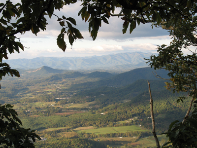
| The Arkaquah Trail is widely regarded to be one of the most challenging and scenic in GA... Looking north from the overlooks, you can see Standing Indian Mtn and even parts of the Smokies as well.
This hike was offered by the AOC a couple of months ago, but on a foggy, drizzly day. As of this writing, the forecast is looking great for Saturday so we are going to try to do it again and this time under sunny skies...and hopefully time it to view in a sweet sunset from the top of Brasstown Bald, the highest mtn in GA. This is an out-and-back hike starting at the BB parking lot. So it will be mostly flat to downhill on the way out...there are some climbs in there on the way out, but not like on the way back. This will get our legs warmed up for the return from Track Rock Gap...beginning with about 1500 feet elevation gain in under two miles. From there it is up and down, but gaining 700 more feet in the next 3 1/2 miles. We will then hike the .6 mile Brasstown Bald trail to the top of the mth where there are superb 360 degree panoramic views to be enjoyed. This is not a beginner hike. If you are an intermediate hiker, you may want to challenge yourself and try this, but be sure you are up for a tough workout as well as a beautiful trail. As with all D5 events, if I have not hiked with you before, I may be contacting you to ask about your previous hiking experiences especially if you don't have similar events in your AOC history. | |||||||
| |||||||
| How to Get There: | |||||||
| Event Directions: | Directions to Trailhead: View Larger Map | ||||||
| Carpool to Event Distance (round trip): | 174Mile(s) | ||||||
| Carpool Departure Time: | 9:15 am | ||||||
| Carpool Location: | Log in for location | ||||||
| Carpool Directions: | Log in for directions | ||||||
| Carpool Cost: | Estimated cost per vehicle for this event is $69.60 using a reimbursement rate guideline of $0.400 per mile. The total amount should be divided by the number of people in the vehicle, including the driver. This is a guideline, not a rule, for drivers but the cost should not be higher unless there are extenuating circumstances. | ||||||
| Notes: | |||||||
|
There is a $3 parking fee at the Brasstown Bald parking area * We encourage all members to follow our Etiquette Guidelines while participating in AOC events. | |||||||
Cancellation/Partial Attendance: Please review the AOC cancellation policy. | |||||||